|
search place name
|
||
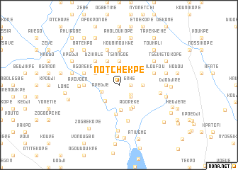
Notchèkpé (Togo)Notchèkpé is a town in Togo. An overview map of the region around Notchèkpé is displayed below.
regional and 3d topo map of Notchèkpé, Togo ::
Notchèkpé airports ::
The nearest airport is LFW - Lome Gnassingbe Eyadema Intl, located 41.5 km south east of Notchèkpé.
Other airports nearby include COO - Cotonou Cadjehoun (144.8 km east), ACC - Accra Kotoka Intl (170.1 km south west), Nearby towns ::
Bediémé (1.8km east) //
Erhé (1.8km east) //
Dèdjé (2.3km south east) //
Flélouvé (2.6km north west) //
Tchati (2.6km south east) //
Avédjé (2.9km west) //
Klokpoé (3.3km south west) //
Tsinngoé (3.7km north) //
Ekpévé (3.7km east) //
Fokoun (3.9km south) //
Amavé (4.1km north west) //
Agoréké (4.1km south east) //
Djogbedji (4.1km north west) //
Dafolényamé (4.1km north west) //
Kpoguédé (4.1km north west) //
Poguiéssou (4.1km south east) //
Dékpo (4.6km south) //
Dzikalé (5.2km north west) //
Koubinoukwé (5.6km north) //
Adjogbénouko (5.5km west) //
Bolou Kpéta (5.8km south) //
Kavéguékopé (5.9km north) //
Agadjakpé (5.9km north) //
Toumé (5.8km east) //
Doulogoé (5.8km east) //
Abazikopé (5.8km west) //
Valoufou (5.8km east) //
Agoréké (5.8km west) //
Avévoen (6.3km west) //
[all distances 'as the bird flies' and approximate] 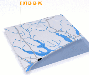 Places with similar names to Notchèkpé, Togo :: Disclaimer :: Information on this page comes without warranty of any kind |
||
|
Where is Notchèkpé? Elevation and coordinates ::
Latitude (lat): 6°30'0"N Longitude (lon): 1°5'0"E
Elevation (approx.): 76m (map arrows pan, magnifying glasses zoom) |
||
|
Visiting Notchèkpé? Hotel/Accommodation ::
Book a hotel in Notchèkpé Travel Guide ::
Buy a travel guide for Togo rental cars ::
car rental offers GPS waypoint ::
download a GPX waypoint (PoI) of Notchèkpé for your GPS receiver
|
||