|
search place name
|
||
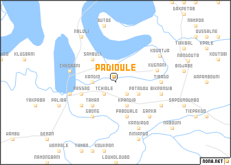
Padioulé (Togo)Padioulé is a town in Togo. An overview map of the region around Padioulé is displayed below.
regional and 3d topo map of Padioulé, Togo ::
Padioulé airports ::
The nearest airport is LRL - Niatougou Niamtougou International, located 89.6 km east of Padioulé.
Other airports nearby include TML - Tamale (127.7 km west), Nearby towns ::
Tchialè (2.6km south west) //
Ntchiado (2.6km south west) //
Nawaré (2.6km south east) //
Kandio (3.7km west) //
Patadou (4.1km south east) //
Kpandia (4.1km south east) //
Sambuli (5.2km north west) //
Dioubo (5.2km south west) //
Taman (5.2km south west) //
Passao (5.8km west) //
Paboualé (5.9km south) //
Gbong (6.7km south west) //
Dondonné (6.6km south west) //
Kugnani (6.9km east) //
Tibado (7.3km east) //
Chegbani (7.5km west) //
Paliba (7.5km west) //
Bikpandib (7.5km east) //
Garka (7.8km south east) //
Kandiado (8.3km south east) //
Louakban (8.2km south east) //
Kountja (8.3km north east) //
Naloli (9.2km north west) //
[all distances 'as the bird flies' and approximate] 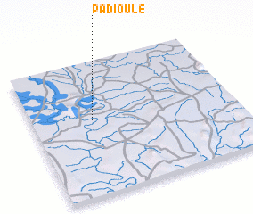 Places with similar names to Padioulé, Togo ::
Disclaimer :: Information on this page comes without warranty of any kind |
||
|
Where is Padioulé? Elevation and coordinates ::
Latitude (lat): 9°34'0"N Longitude (lon): 0°18'0"W
Elevation (approx.): 102m (map arrows pan, magnifying glasses zoom) |
||
|
Visiting Padioulé? Hotel/Accommodation ::
Book a hotel in Padioulé Travel Guide ::
Buy a travel guide for Togo rental cars ::
car rental offers GPS waypoint ::
download a GPX waypoint (PoI) of Padioulé for your GPS receiver
|
||