|
search place name
|
||
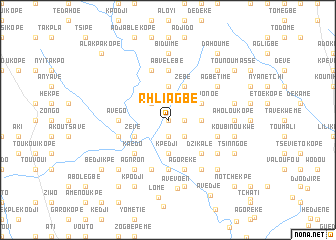
Rhli Agbé (Togo)Rhli Agbé is a town in Togo. An overview map of the region around Rhli Agbé is displayed below.
regional and 3d topo map of Rhli Agbé, Togo ::
Rhli Agbé airports ::
The nearest airport is LFW - Lome Gnassingbe Eyadema Intl, located 51.6 km south east of Rhli Agbé.
Other airports nearby include COO - Cotonou Cadjehoun (153.1 km east), ACC - Accra Kotoka Intl (168.7 km south west), Nearby towns ::
Anazivé (0.0km north) //
Djatikpo (1.8km east) //
Abidikopé (1.9km south) //
Atchavé (2.6km north west) //
Batékpo (2.6km south east) //
Avégan (3.7km north) //
Agodoukopé (3.7km east) //
Nyassivé (3.7km east) //
Kpédji (3.7km south) //
Zébé (4.1km north east) //
Djébé (4.1km north east) //
Afokponoé (4.1km north east) //
Zévé (4.1km south west) //
Dzikalé (5.2km south east) //
Kaédo (5.2km south west) //
Ziovémé (5.6km south) //
Kpévé (5.6km north) //
Abvélébé (5.6km north) //
Avégo (5.5km west) //
Agoréké (5.9km south) //
Abazikopé (5.9km south) //
Agotimé (5.9km south) //
Lokodopé (5.9km north) //
Kaédo (5.9km south) //
Agblédo (5.8km west) //
Nagblé Kopé (5.8km west) //
Agadjakpé (5.8km east) //
Kavéguékopé (5.8km east) //
Dafolényamé (6.7km south east) //
[all distances 'as the bird flies' and approximate] 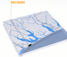 Places with similar names to Rhli Agbé, Togo :: Disclaimer :: Information on this page comes without warranty of any kind |
||
|
Where is Rhli Agbé? Elevation and coordinates ::
Latitude (lat): 6°34'0"N Longitude (lon): 1°1'0"E
Elevation (approx.): 81m (map arrows pan, magnifying glasses zoom) |
||
|
Visiting Rhli Agbé? Hotel/Accommodation ::
Book a hotel in Rhli Agbé Travel Guide ::
Buy a travel guide for Togo rental cars ::
car rental offers GPS waypoint ::
download a GPX waypoint (PoI) of Rhli Agbé for your GPS receiver
|
||