|
search place name
|
||
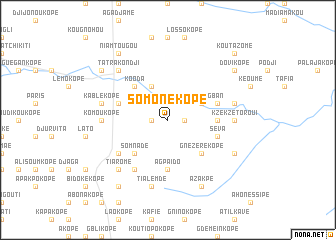
Somonékopé (Togo)Somonékopé is a town in Togo. An overview map of the region around Somonékopé is displayed below.
regional and 3d topo map of Somonékopé, Togo ::
Somonékopé airports ::
The nearest airport is LFW - Lome Gnassingbe Eyadema Intl, located 107.1 km south of Somonékopé.
Other airports nearby include COO - Cotonou Cadjehoun (155.0 km south east), ACC - Accra Kotoka Intl (228.0 km south west), Nearby towns ::
Komlakopé (1.8km east) //
Samanoukopé (1.8km west) //
Afidégnigban (4.1km north east) //
Gota (4.1km north west) //
Gotakablé (4.1km north west) //
Gnézérékopé (5.2km south east) //
Somnadé (5.2km south west) //
Kooda (5.2km north west) //
Komé (5.5km east) //
Agpaïdo (5.6km south) //
Séva (5.8km east) //
Lomnava (5.8km east) //
Kablikpé (5.8km west) //
Diaokopé (6.6km south west) //
Kolédjikopé (6.7km south west) //
Kzékzétoroui (7.4km east) //
Komoukopé (7.4km west) //
Kokpli (7.6km east) //
Tialemdé (7.6km south) //
Kablékopé (7.6km west) //
Kra (7.8km north west) //
Tatrakondji (7.8km north west) //
Saramakopé (7.8km south west) //
Tiaromé (7.8km south west) //
Djapatakopé (8.2km south east) //
Azakpé (8.3km south east) //
Dovikopé (9.2km north east) //
Koudokodji (9.2km south west) //
Karigora (9.2km north west) //
[all distances 'as the bird flies' and approximate]  Places with similar names to Somonékopé, Togo ::
// Xóm Ngáp (VN)
// Samanoukopé (TG)
Disclaimer :: Information on this page comes without warranty of any kind |
||
|
Where is Somonékopé? Elevation and coordinates ::
Latitude (lat): 7°8'0"N Longitude (lon): 1°13'0"E
Elevation (approx.): 142m (map arrows pan, magnifying glasses zoom) |
||
|
Visiting Somonékopé? Hotel/Accommodation ::
Book a hotel in Somonékopé Travel Guide ::
Buy a travel guide for Togo rental cars ::
car rental offers GPS waypoint ::
download a GPX waypoint (PoI) of Somonékopé for your GPS receiver
|
||