|
search place name
|
||
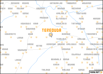
Téréouda (Togo)Téréouda is a town in Togo. An overview map of the region around Téréouda is displayed below.
regional and 3d topo map of Téréouda, Togo ::
Téréouda airports ::
The nearest airport is LRL - Niatougou Niamtougou International, located 29.4 km west of Téréouda.
Nearby towns ::
Kadianga (1.8km west) //
Alemandé (1.9km north) //
Assaradè (2.6km south east) //
Kémèrida (3.7km south) //
Tchaladè (4.1km south east) //
Wakèdè (5.2km south east) //
Kadolassi (5.2km north east) //
Akaradè (5.5km east) //
Aloumboukou (5.5km west) //
Sonagouda (5.8km east) //
Bohoumkoara (5.8km east) //
Sonaholou (5.8km east) //
Dompago (5.8km east) //
Kétao (6.1km south west) //
Pagouda (6.3km north west) //
Kawa (6.6km north west) //
Alitokoum (6.7km north east) //
Booumoo (7.3km east) //
Dewa (7.3km west) //
Siou Kawa (7.5km west) //
Kassadé (7.6km north) //
Wèkèdè (7.8km south east) //
Kooumdè (7.8km south east) //
Kpèloudè (8.2km south east) //
Kassé (8.2km south west) //
Kpalholé (8.3km north east) //
Kawado (9.2km north east) //
[all distances 'as the bird flies' and approximate]  Places with similar names to Téréouda, Togo ::
Disclaimer :: Information on this page comes without warranty of any kind |
||
|
Where is Téréouda? Elevation and coordinates ::
Latitude (lat): 9°42'0"N Longitude (lon): 1°21'0"E
Elevation (approx.): 390m (map arrows pan, magnifying glasses zoom) |
||
|
Visiting Téréouda? Hotel/Accommodation ::
Book a hotel in Téréouda Travel Guide ::
Buy a travel guide for Togo rental cars ::
car rental offers GPS waypoint ::
download a GPX waypoint (PoI) of Téréouda for your GPS receiver
|
||