|
search place name
|
||
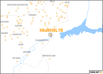
Kajakī ‘Olyā (Helmand, Afghanistan)Kajakī ‘Olyā is a town in the Helmand region of Afghanistan. An overview map of the region around Kajakī ‘Olyā is displayed below.
regional and 3d topo map of Kajakī ‘Olyā, Afghanistan ::
Kajakī ‘Olyā airports ::
The nearest airport is KDH - Kandahar, located 113.9 km south east of Kajakī ‘Olyā.
Nearby towns ::
Shābāz Kheyl (2.8km north west) //
Kānzī (3.2km north west) //
Bagār Kheyl (3.7km north) //
Qal‘eh-ye Gol (3.9km north) //
Kajakī Soflá (3.6km south west) //
Māchī Kheyl (4.7km north west) //
Khvolehābād (4.9km north) //
Kajī (5.3km north) //
Bībānak (5.5km north) //
Khāk-e Jahannam (6.3km north) //
Ḩeydar Būghchī (6.8km north) //
Navay Kārīz (6.7km north west) //
Kalīzeh (7.0km north) //
Ākhvond Kheyl (7.7km north) //
Khvājeh ‘Azīz (7.8km north) //
Band-e Kajakī (7.9km south) //
Kārīzdī (7.9km north) //
Gandom Rīz-e Soflá (7.9km north) //
Mār Khvor-e Soflá (7.9km north east) //
Mār Khvor-e ‘Olyā (8.1km north east) //
Mīrzī (8.2km north) //
Sabzīkār (7.9km north west) //
Torkak (8.8km north) //
Ḩājjī Kheyl (8.3km north west) //
Taghāvī (9.0km north west) //
Jaryeh (9.7km north east) //
Garm Āb (9.8km south west) //
[all distances 'as the bird flies' and approximate] 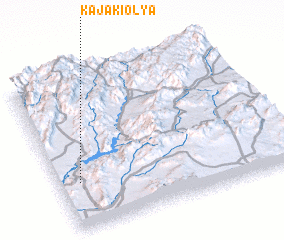 Places with similar names to Kajakī ‘Olyā, Afghanistan ::
// Qūyjūq-e ‘Olyā (IR)
Disclaimer :: Information on this page comes without warranty of any kind |
||
|
Where is Kajakī ‘Olyā? Elevation and coordinates ::
Latitude (lat): 32°18'14"N Longitude (lon): 65°5'25"E
Elevation (approx.): 945m (map arrows pan, magnifying glasses zoom) |
||
|
Visiting Kajakī ‘Olyā? Hotel/Accommodation ::
Book a hotel in Kajakī ‘Olyā Travel Guide ::
Buy a travel guide for Afghanistan rental cars ::
car rental offers GPS waypoint ::
download a GPX waypoint (PoI) of Kajakī ‘Olyā for your GPS receiver
|
||