|
search place name
|
||
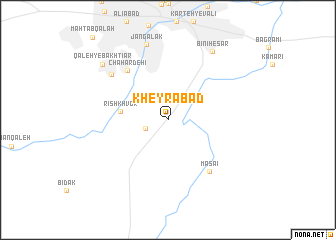
Kheyrābād (Kābol, Afghanistan)Kheyrābād is a town in the Kābol region of Afghanistan. An overview map of the region around Kheyrābād is displayed below.
regional and 3d topo map of Kheyrābād, Afghanistan ::
Kheyrābād airports ::
The nearest airport is KBL - Kabul Intl, located 16.8 km north of Kheyrābād.
Other airports nearby include JAA - Jalalabad (121.7 km east), Nearby towns ::
Chahār Āsīāb (2.3km south west) //
Rīsh Khvor (4.5km west) //
Chahār Dehī (6.7km north west) //
Masa'ī (6.9km south east) //
Dār ol Amān (7.3km north west) //
Jangalak (8.7km north) //
Bīnī Ḩeşār (8.7km north east) //
Qal‘eh-ye Bakhtīār (8.7km north west) //
[all distances 'as the bird flies' and approximate] 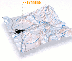 Places with similar names to Kheyrābād, Afghanistan ::
Disclaimer :: Information on this page comes without warranty of any kind |
||
|
Where is Kheyrābād? Elevation and coordinates ::
Latitude (lat): 34°25'5"N Longitude (lon): 69°10'29"E
Elevation (approx.): 1815m (map arrows pan, magnifying glasses zoom) |
||
|
Visiting Kheyrābād? Hotel/Accommodation ::
Book a hotel in Kheyrābād Travel Guide ::
Buy a travel guide for Afghanistan rental cars ::
car rental offers GPS waypoint ::
download a GPX waypoint (PoI) of Kheyrābād for your GPS receiver
|
||