|
search place name
|
||
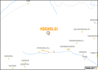
Moghol Gī (Afghanistan)Moghol Gī is a town in Afghanistan. An overview map of the region around Moghol Gī is displayed below.
regional and 3d topo map of Moghol Gī, Afghanistan ::
Moghol Gī airports ::
The nearest airport is JAA - Jalalabad, located 151.0 km north of Moghol Gī.
Other airports nearby include KBL - Kabul Intl (171.2 km north), PEW - Peshawar Intl (177.7 km north east), PZH - Zhob (201.1 km south), Nearby towns ::
Tor Kade Khel Kili (6.2km south) //
Atak Khel Kili (6.1km south) //
Mīrdād Khel Kili (6.3km south) //
Lāli Faqīrān Kili (6.4km south) //
Mādak Khel Kili (6.3km south) //
Sare Kaue Khel Kili (6.5km south) //
Kār Kili (6.7km south) //
Nazarbeg Khel Kili (7.2km south west) //
Kanibagh Ziārat (7.9km south east) //
Kāka Khel Kili (8.1km south east) //
Pai Muhammad Kili (8.3km south east) //
Shodād Khel Kili (8.4km south east) //
[all distances 'as the bird flies' and approximate] 
Disclaimer :: Information on this page comes without warranty of any kind |
||
|
Where is Moghol Gī? Elevation and coordinates ::
Latitude (lat): 33°8'0"N Longitude (lon): 69°54'0"E
Elevation (approx.): 1563m (map arrows pan, magnifying glasses zoom) |
||
|
Visiting Moghol Gī? Hotel/Accommodation ::
Book a hotel in Moghol Gī Travel Guide ::
Buy a travel guide for Afghanistan rental cars ::
car rental offers GPS waypoint ::
download a GPX waypoint (PoI) of Moghol Gī for your GPS receiver
|
||