|
search place name
|
||
Poshteh-ye Mazār (Bāmīān, Afghanistan)Poshteh-ye Mazār is a town in the Bāmīān region of Afghanistan. An overview map of the region around Poshteh-ye Mazār is displayed below.
regional and 3d topo map of Poshteh-ye Mazār, Afghanistan ::

Poshteh-ye Mazār airports ::
The nearest airport is KBL - Kabul Intl, located 102.9 km east of Poshteh-ye Mazār.
Other airports nearby include UND - Kunduz Konduz (211.1 km north), MZR - Mazar-i-sharif Mazar I Sharif (221.2 km north), Nearby towns ::
Ghowjūrak (0.0km north) //
Shombol (1.5km east) //
Khāk-e Bābeh (2.4km north east) //
Shībar (2.4km north west) //
Valāyatak (2.4km south east) //
Zay Solţān (3.7km north) //
Qalā-ye ‘Abbās (3.6km north east) //
Zāyemān (3.6km south west) //
Char Kateh (4.8km south west) //
Dākī (4.9km east) //
Dahan-e Khawāl (5.8km north) //
Qal‘eh-ye Feyẕī (5.8km north) //
Nāveh (5.8km south) //
Dīvālak-e ‘Olyā (7.6km north) //
Bolowleh (6.4km west) //
Khoshkak (6.4km west) //
Lāgharak (8.0km north) //
Qavrīak (8.0km north) //
Kāfar Qalā (7.1km north east) //
Spī Sangak (7.1km north east) //
Lalmā (8.7km south east) //
[all distances 'as the bird flies' and approximate] 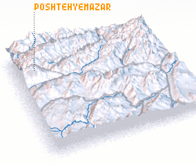 Places with similar names to Poshteh-ye Mazār, Afghanistan :: Disclaimer :: Information on this page comes without warranty of any kind |
||
|
Where is Poshteh-ye Mazār? Elevation and coordinates ::
Latitude (lat): 34°52'0"N Longitude (lon): 68°9'0"E
Elevation (approx.): 2833m (map arrows pan, magnifying glasses zoom) |
||
|
Visiting Poshteh-ye Mazār? Hotel/Accommodation ::
Book a hotel in Poshteh-ye Mazār Travel Guide ::
Buy a travel guide for Afghanistan rental cars ::
car rental offers GPS waypoint ::
download a GPX waypoint (PoI) of Poshteh-ye Mazār for your GPS receiver
|
||