|
search place name
|
||
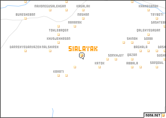
Sīālāyak (Bāmīān, Afghanistan)Sīālāyak is a town in the Bāmīān region of Afghanistan. An overview map of the region around Sīālāyak is displayed below.
regional and 3d topo map of Sīālāyak, Afghanistan ::
Sīālāyak airports ::
The nearest airport is KBL - Kabul Intl, located 145.9 km east of Sīālāyak.
Other airports nearby include MZR - Mazar-i-sharif Mazar I Sharif (222.3 km north), UND - Kunduz Konduz (243.5 km north east), Nearby towns ::
Chehel Tan (2.4km south west) //
Katok (3.6km south east) //
Zard Khavāl (4.8km south west) //
Bolāgh-e Sabz (4.6km east) //
Kamatī (5.9km south west) //
Khvājeh Ḩasan (5.9km north west) //
Sorkh Jūy (6.1km east) //
Lādū (6.4km west) //
Nāl Shīreh (6.4km west) //
Mamarak (7.6km north) //
Towl-e Bāqer (7.2km north west) //
Towl-e Gol Mohammad (7.2km north west) //
‘Ambar Samūch (8.7km north west) //
[all distances 'as the bird flies' and approximate] 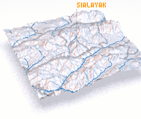 Places with similar names to Sīālāyak, Afghanistan ::
Disclaimer :: Information on this page comes without warranty of any kind |
||
|
Where is Sīālāyak? Elevation and coordinates ::
Latitude (lat): 34°44'0"N Longitude (lon): 67°38'0"E
Elevation (approx.): 2982m (map arrows pan, magnifying glasses zoom) |
||
|
Visiting Sīālāyak? Hotel/Accommodation ::
Book a hotel in Sīālāyak Travel Guide ::
Buy a travel guide for Afghanistan rental cars ::
car rental offers GPS waypoint ::
download a GPX waypoint (PoI) of Sīālāyak for your GPS receiver
|
||