|
search place name
|
||
Soleymān Kalay (Helmand, Afghanistan)Soleymān Kalay is a town in the Helmand region of Afghanistan. An overview map of the region around Soleymān Kalay is displayed below.
regional and 3d topo map of Soleymān Kalay, Afghanistan ::
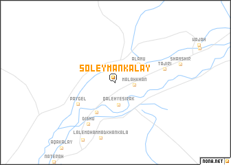
Nearby towns ::
Malah Khān (2.7km east) //
Qal‘eh-ye Sīrak (3.6km south) //
‘Alamū (4.3km north east) //
Qal‘eh-ye Mortaẕá (5.5km south west) //
Pāygel (6.4km south west) //
Dīshū (7.8km south west) //
Tājīrī (7.2km east) //
[all distances 'as the bird flies' and approximate]  Places with similar names to Soleymān Kalay, Afghanistan ::
// Soleymān Kolā (IR)
// Sulaimān Kili (PK)
// Solaymān Kalay (AF)
// Salmenkylä (FI)
// Salmenkylä (FI)
// Salmenkylä (FI)
// Salmenkylä (FI)
// Salmenkylä (FI)
Disclaimer :: Information on this page comes without warranty of any kind |
||
|
Where is Soleymān Kalay? Elevation and coordinates ::
Latitude (lat): 30°29'43"N Longitude (lon): 63°21'29"E
Elevation (approx.): 601m (map arrows pan, magnifying glasses zoom) |
||
|
Visiting Soleymān Kalay? Hotel/Accommodation ::
Book a hotel in Soleymān Kalay Travel Guide ::
Buy a travel guide for Afghanistan rental cars ::
car rental offers GPS waypoint ::
download a GPX waypoint (PoI) of Soleymān Kalay for your GPS receiver
|
||