|
search place name
|
||
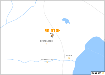
Spīn Tak (Ghaznī, Afghanistan)Spīn Tak is a town in the Ghaznī region of Afghanistan. An overview map of the region around Spīn Tak is displayed below.
regional and 3d topo map of Spīn Tak, Afghanistan ::
Spīn Tak airports ::
The nearest airport is PZH - Zhob, located 208.7 km south east of Spīn Tak.
Other airports nearby include KDH - Kandahar (218.6 km south west), KBL - Kabul Intl (256.8 km north east), Nearby towns ::
Behbūḏ Kalā (2.8km south west) //
Jabbār Kalā (8.9km south) //
Gārah (8.9km south east) //
[all distances 'as the bird flies' and approximate]  Places with similar names to Spīn Tak, Afghanistan ::
// Cipandak (ID)
// Cipandak (ID)
// Cipeundeuy 2 (ID)
// Cipondok (ID)
// Cipondok (ID)
// Cipondok (ID)
// Spantekow (DE)
// Spina Takka (PK)
// Spīn Takai (PK)
// Spanidiga (HR)
Disclaimer :: Information on this page comes without warranty of any kind |
||
|
Where is Spīn Tak? Elevation and coordinates ::
Latitude (lat): 32°34'57"N Longitude (lon): 67°47'10"E
Elevation (approx.): 2023m (map arrows pan, magnifying glasses zoom) |
||
|
Visiting Spīn Tak? Hotel/Accommodation ::
Book a hotel in Spīn Tak Travel Guide ::
Buy a travel guide for Afghanistan rental cars ::
car rental offers GPS waypoint ::
download a GPX waypoint (PoI) of Spīn Tak for your GPS receiver
|
||