|
search place name
|
||
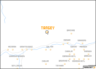
Tangey (Parvān, Afghanistan)Tangey is a town in the Parvān region of Afghanistan. An overview map of the region around Tangey is displayed below.
regional and 3d topo map of Tangey, Afghanistan ::
Tangey airports ::
The nearest airport is KBL - Kabul Intl, located 67.7 km south east of Tangey.
Other airports nearby include JAA - Jalalabad (175.8 km south east), UND - Kunduz Konduz (181.4 km north), MZR - Mazar-i-sharif Mazar I Sharif (231.3 km north west), Nearby towns ::
Dahan-e Pārsā (5.9km south) //
Chahār Deh-ye Ghowrband (5.9km south) //
Galyān (5.9km south) //
Ghowr Band (6.2km south east) //
Rangān (7.1km south east) //
Ferenjal (7.9km south west) //
Dasht-e Kavāz (8.9km south west) //
Dahan-e Zaw (8.9km south west) //
Chamlay (10.3km south east) //
Lālā Kheyl (10.3km south east) //
[all distances 'as the bird flies' and approximate] 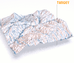 Places with similar names to Tangey, Afghanistan ::
Disclaimer :: Information on this page comes without warranty of any kind |
||
|
Where is Tangey? Elevation and coordinates ::
Latitude (lat): 35°2'9"N Longitude (lon): 68°44'28"E
Elevation (approx.): 2333m (map arrows pan, magnifying glasses zoom) |
||
|
Visiting Tangey? Hotel/Accommodation ::
Book a hotel in Tangey Travel Guide ::
Buy a travel guide for Afghanistan rental cars ::
car rental offers GPS waypoint ::
download a GPX waypoint (PoI) of Tangey for your GPS receiver
|
||