|
search place name
|
||
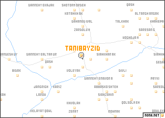
Tanī Bāyzīd (Vardak, Afghanistan)Tanī Bāyzīd is a town in the Vardak region of Afghanistan. An overview map of the region around Tanī Bāyzīd is displayed below.
regional and 3d topo map of Tanī Bāyzīd, Afghanistan ::
Tanī Bāyzīd airports ::
The nearest airport is KBL - Kabul Intl, located 151.0 km east of Tanī Bāyzīd.
Nearby towns ::
Būm (1.9km south) //
Dīvāl (1.5km east) //
Qal‘eh-ye Sepī Sang (2.4km north west) //
Voleyak (4.0km south) //
Sīāh Khārak (4.6km east) //
Zard ‘Olūm (5.6km north) //
Nāvor (4.9km east) //
Darreh-ye Nāvorā (6.3km south east) //
Dahan-e Dīvāl (7.4km north) //
Qāsh (6.4km west) //
‘Abbās Koshteh (8.7km south east) //
Kārīz (8.7km south west) //
Ţavlay Qowl (9.6km south east) //
[all distances 'as the bird flies' and approximate] 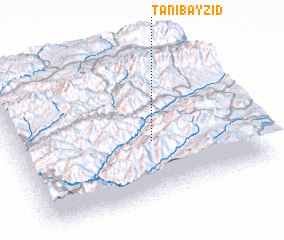 Places with similar names to Tanī Bāyzīd, Afghanistan ::
// Tonb Basāt (IR)
Disclaimer :: Information on this page comes without warranty of any kind |
||
|
Where is Tanī Bāyzīd? Elevation and coordinates ::
Latitude (lat): 34°23'0"N Longitude (lon): 67°35'0"E
Elevation (approx.): 2959m (map arrows pan, magnifying glasses zoom) |
||
|
Visiting Tanī Bāyzīd? Hotel/Accommodation ::
Book a hotel in Tanī Bāyzīd Travel Guide ::
Buy a travel guide for Afghanistan rental cars ::
car rental offers GPS waypoint ::
download a GPX waypoint (PoI) of Tanī Bāyzīd for your GPS receiver
|
||