|
search place name
|
||
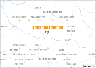
Banza Soba Iango (Cuanza Norte, Angola)Banza Soba Iango is a town in the Cuanza Norte region of Angola. An overview map of the region around Banza Soba Iango is displayed below.
regional and 3d topo map of Banza Soba Iango, Angola ::
Banza Soba Iango airports ::
The nearest airport is GXG - Negage, located 149.8 km north east of Banza Soba Iango.
Other airports nearby include UGO - Uige (156.5 km north), LAD - Luanda 4 De Fevereiro (164.0 km west), MEG - Malanje (185.3 km east), PBN - Porto Amboim (218.8 km south west), Nearby towns ::
Muenembala (5.6km south) //
Banza de Quilombo (5.9km north) //
Sende (6.7km south west) //
Granja Açores (6.7km north west) //
Quilombo dos Dembos (7.6km north) //
Tande (8.2km south east) //
Fazenda Quiluange (8.3km south west) //
Muenga do Bango (9.2km north east) //
Cavunga Capacaça (9.2km north west) //
Gombe-Anambua (9.2km north west) //
Mungo (9.2km south east) //
[all distances 'as the bird flies' and approximate] 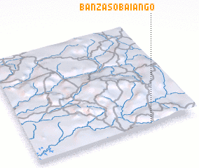 Places with similar names to Banza Soba Iango, Angola :: Disclaimer :: Information on this page comes without warranty of any kind |
||
|
Where is Banza Soba Iango? Elevation and coordinates ::
Latitude (lat): 8°59'0"S Longitude (lon): 14°43'0"E
Elevation (approx.): 567m (map arrows pan, magnifying glasses zoom) |
||
|
Visiting Banza Soba Iango? Hotel/Accommodation ::
Book a hotel in Banza Soba Iango Travel Guide ::
Buy a travel guide for Angola rental cars ::
car rental offers GPS waypoint ::
download a GPX waypoint (PoI) of Banza Soba Iango for your GPS receiver
|
||