|
search place name
|
||
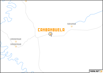
Cambambuela (Lunda Sul, Angola)Cambambuela is a town in the Lunda Sul region of Angola. An overview map of the region around Cambambuela is displayed below.
regional and 3d topo map of Cambambuela, Angola ::
Cambambuela airports ::
The nearest airport is LUO - Luena, located 200.9 km south east of Cambambuela.
Other airports nearby include VHC - Saurimo (212.0 km north east), SVP - Kuito (286.5 km south west), Nearby towns ::
Savungo (8.2km north east) //
[all distances 'as the bird flies' and approximate] 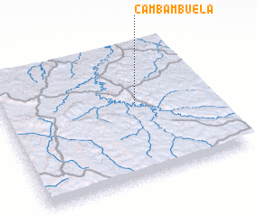 Places with similar names to Cambambuela, Angola ::
// Gumamela (PH)
// Cumbee Mill (US)
// Kamembele (CD)
// Koumamala (GA)
// Kambaumbali (ZM)
// Kama Malli (PK)
// Kambambolou (GN)
// Kumimal (KP)
// Kambumula (MW)
Disclaimer :: Information on this page comes without warranty of any kind |
||
|
Where is Cambambuela? Elevation and coordinates ::
Latitude (lat): 10°26'0"S Longitude (lon): 18°39'0"E
Elevation (approx.): 1243m (map arrows pan, magnifying glasses zoom) |
||
|
Visiting Cambambuela? Hotel/Accommodation ::
Book a hotel in Cambambuela Travel Guide ::
Buy a travel guide for Angola rental cars ::
car rental offers GPS waypoint ::
download a GPX waypoint (PoI) of Cambambuela for your GPS receiver
|
||