|
search place name
|
||
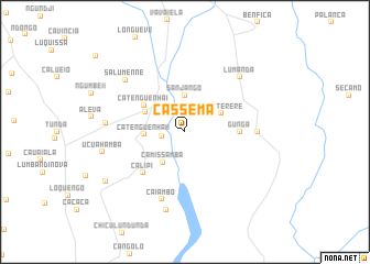
Cassema (Huambo, Angola)Cassema is a town in the Huambo region of Angola. An overview map of the region around Cassema is displayed below.
regional and 3d topo map of Cassema, Angola ::
Cassema airports ::
The nearest airport is NOV - Huambo, located 19.3 km north of Cassema.
Other airports nearby include SVP - Kuito (145.0 km north east), SPP - Menongue (282.3 km south east), Nearby towns ::
Tchilova (2.4km west) //
Sanjango (3.7km north) //
Camissamba (3.8km south west) //
Saluterere (4.1km north east) //
Catenguenha II (4.0km west) //
Tchindundule (4.4km north west) //
Catenguenha I (4.9km north west) //
Gunga (5.4km east) //
Calipi (5.9km south west) //
Caiambo (7.2km south) //
Cumbão (7.2km east) //
Gulaúa (7.2km east) //
Lumanda (7.8km north east) //
Salumenne (7.9km north west) //
Ngumbe (7.9km west) //
Beque (8.1km south) //
Ucuahamba (8.4km west) //
Cuahamba (9.4km south west) //
[all distances 'as the bird flies' and approximate] 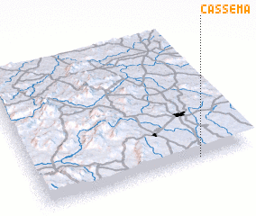 Places with similar names to Cassema, Angola ::
Disclaimer :: Information on this page comes without warranty of any kind |
||
|
Where is Cassema? Elevation and coordinates ::
Latitude (lat): 12°59'0"S Longitude (lon): 15°45'0"E
Elevation (approx.): 1643m (map arrows pan, magnifying glasses zoom) |
||
|
Visiting Cassema? Hotel/Accommodation ::
Book a hotel in Cassema Travel Guide ::
Buy a travel guide for Angola rental cars ::
car rental offers GPS waypoint ::
download a GPX waypoint (PoI) of Cassema for your GPS receiver
|
||