|
search place name
|
||
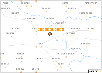
Chongolongo (Huambo, Angola)Chongolongo is a town in the Huambo region of Angola. An overview map of the region around Chongolongo is displayed below.
regional and 3d topo map of Chongolongo, Angola ::
Chongolongo airports ::
The nearest airport is NOV - Huambo, located 70.1 km south of Chongolongo.
Other airports nearby include SVP - Kuito (150.1 km east), PBN - Porto Amboim (257.0 km north west), Nearby towns ::
Salomão (5.2km south west) //
Wama (5.2km south west) //
Candande (5.2km north east) //
Cambala (5.6km north) //
Gungo (5.7km west) //
Salibondue (6.6km south west) //
Muecária (7.2km east) //
Lumbanje (9.1km north west) //
Fazenda da Bonga (9.2km south east) //
[all distances 'as the bird flies' and approximate]  Places with similar names to Chongolongo, Angola ::
// Shangleng (MM)
// Shenglang Ga (MM)
// Shingling (MM)
// Shungulunga (CD)
// Changlung (IN)
// Chinkalanga (ZM)
// Chungulengo (MZ)
// Ch'ang-liang (TW)
// Ch'ang-lung (TW)
// Ch'eng-lung (TW)
Disclaimer :: Information on this page comes without warranty of any kind |
||
|
Where is Chongolongo? Elevation and coordinates ::
Latitude (lat): 12°12'0"S Longitude (lon): 15°35'0"E
Elevation (approx.): 1424m (map arrows pan, magnifying glasses zoom) |
||
|
Visiting Chongolongo? Hotel/Accommodation ::
Book a hotel in Chongolongo Travel Guide ::
Buy a travel guide for Angola rental cars ::
car rental offers GPS waypoint ::
download a GPX waypoint (PoI) of Chongolongo for your GPS receiver
|
||