|
search place name
|
||
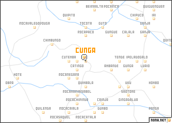
Cunga (Cuanza Sul, Angola)Cunga is a town in the Cuanza Sul region of Angola. An overview map of the region around Cunga is displayed below.
regional and 3d topo map of Cunga, Angola ::
Cunga airports ::
The nearest airport is PBN - Porto Amboim, located 85.2 km north west of Cunga.
Other airports nearby include BUG - Benguela (165.0 km south west), NOV - Huambo (233.0 km south east), Nearby towns ::
Bango (0.0km north) //
Conga (1.8km west) //
Catingo (2.6km south west) //
Cutemba (3.6km west) //
Anda (4.1km south west) //
Roça Negara (5.2km south west) //
Roça Paco (5.6km north) //
Quimbala (5.6km south) //
Catanda (5.6km south) //
Hombo (5.6km south) //
Ambande (5.8km east) //
Tende (7.3km east) //
Combira e Ingongolo (7.3km east) //
Tocota (7.4km north) //
Roça Maria Isabel (7.6km south) //
Gungue (7.8km north east) //
Chimbungo (8.2km north west) //
Guto (8.3km north east) //
Ingongom (9.2km south east) //
[all distances 'as the bird flies' and approximate] 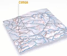 Places with similar names to Cunga, Angola ::
Disclaimer :: Information on this page comes without warranty of any kind |
||
|
Where is Cunga? Elevation and coordinates ::
Latitude (lat): 11°21'0"S Longitude (lon): 14°13'0"E
Elevation (approx.): 1026m (map arrows pan, magnifying glasses zoom) |
||
|
Visiting Cunga? Hotel/Accommodation ::
Book a hotel in Cunga Travel Guide ::
Buy a travel guide for Angola rental cars ::
car rental offers GPS waypoint ::
download a GPX waypoint (PoI) of Cunga for your GPS receiver
|
||