|
search place name
|
||
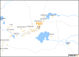
Fuxi (Bengo, Angola)Fuxi is a town in the Bengo region of Angola. An overview map of the region around Fuxi is displayed below.
regional and 3d topo map of Fuxi, Angola ::
Fuxi airports ::
The nearest airport is LAD - Luanda 4 De Fevereiro, located 57.9 km south west of Fuxi.
Other airports nearby include UGO - Uige (183.9 km north east), GXG - Negage (199.6 km north east), Nearby towns ::
Cabocha (0.6km south west) //
Cariongo (0.8km north) //
Quitonhi (1.3km north) //
Quitangola (1.4km north) //
Caxito (1.5km west) //
Bula (1.6km south west) //
Mifuma (2.3km west) //
Paranhos (2.7km north) //
Quindungula (2.9km south west) //
Sassa Povoação (3.0km north) //
Quingombe (3.1km west) //
Quixiquela (3.5km west) //
Bispo (3.7km west) //
Santana (3.9km west) //
Quimanda (4.0km north east) //
Bucula (4.2km north west) //
Cambambi (4.5km west) //
Mitonde (5.2km south west) //
Cambambi (5.4km west) //
Mabubas (5.8km north) //
Quirindo (6.1km south west) //
Morima (6.6km south east) //
Tentativa (7.0km west) //
Quissoma (7.3km west) //
Quissari (8.0km south west) //
Lembeca (8.1km north east) //
Açucareira (8.1km west) //
Sassa Cária (8.6km west) //
Capunga (9.0km south west) //
[all distances 'as the bird flies' and approximate] 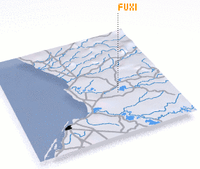 Places with similar names to Fuxi, Angola ::
Disclaimer :: Information on this page comes without warranty of any kind |
||
|
Where is Fuxi? Elevation and coordinates ::
Latitude (lat): 8°34'51"S Longitude (lon): 13°40'40"E
Elevation (approx.): 23m (map arrows pan, magnifying glasses zoom) |
||
|
Visiting Fuxi? Hotel/Accommodation ::
Book a hotel in Fuxi Travel Guide ::
Buy a travel guide for Angola rental cars ::
car rental offers GPS waypoint ::
download a GPX waypoint (PoI) of Fuxi for your GPS receiver
|
||