|
search place name
|
||
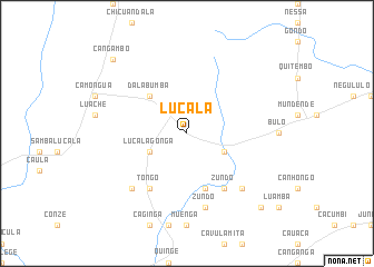
Lucala (Malanje, Angola)Lucala is a town in the Malanje region of Angola. An overview map of the region around Lucala is displayed below.
regional and 3d topo map of Lucala, Angola ::
Lucala airports ::
The nearest airport is MEG - Malanje, located 91.3 km south east of Lucala.
Other airports nearby include GXG - Negage (141.5 km north), UGO - Uige (168.0 km north west), PBN - Porto Amboim (287.6 km south west), Nearby towns ::
Lucalagonga (4.1km south west) //
Dominingos Zundo (4.1km south east) //
Dalabumba (5.2km north west) //
Luenze (5.9km south) //
Tongo (6.7km south west) //
Zundo (6.7km south east) //
Zundo (7.6km south) //
Candumba (7.8km south west) //
Muondo (7.8km south east) //
João Gulome (10.4km south east) //
Cangambo (10.4km north west) //
[all distances 'as the bird flies' and approximate] 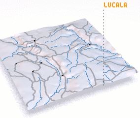 Places with similar names to Lucala, Angola ::
Disclaimer :: Information on this page comes without warranty of any kind |
||
|
Where is Lucala? Elevation and coordinates ::
Latitude (lat): 8°58'0"S Longitude (lon): 15°42'0"E
Elevation (approx.): 1176m (map arrows pan, magnifying glasses zoom) |
||
|
Visiting Lucala? Hotel/Accommodation ::
Book a hotel in Lucala Travel Guide ::
Buy a travel guide for Angola rental cars ::
car rental offers GPS waypoint ::
download a GPX waypoint (PoI) of Lucala for your GPS receiver
|
||