|
search place name
|
||
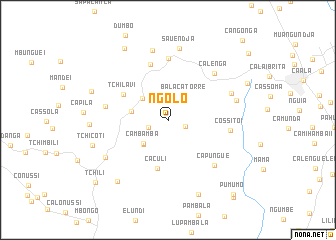
Ngolo (Huambo, Angola)Ngolo is a town in the Huambo region of Angola. An overview map of the region around Ngolo is displayed below.
regional and 3d topo map of Ngolo, Angola ::
Ngolo airports ::
The nearest airport is NOV - Huambo, located 37.7 km east of Ngolo.
Other airports nearby include SVP - Kuito (174.0 km east), Nearby towns ::
Calomanda I (2.1km east) //
Cassanda (2.3km west) //
Balaca Torre (3.2km north east) //
Lépi (3.7km north west) //
Cambamba (3.8km south west) //
Jone (3.8km south west) //
Tchinila (4.0km west) //
Caculi (5.6km south) //
Tchilavi (5.6km north west) //
Mangonga I (6.5km north) //
Sidónio Pais (6.9km north) //
Cossito I (6.9km east) //
Capila (7.0km west) //
Capungue (7.2km south east) //
Calenga (7.2km north east) //
Calomanda III (7.5km north east) //
Calomanda II (7.8km east) //
Cassanda (8.0km north) //
Tchicanda (8.0km south west) //
Sauendja (8.1km north) //
Mbungue (8.6km west) //
Catetele (8.8km south west) //
Tchicoti (8.7km west) //
Capinganlo (9.0km south) //
Jilacalimi II (8.9km west) //
Opoli (9.3km north west) //
Calai Brita (9.6km north east) //
Tchili (10.5km south west) //
Pumumo (11.0km south east) //
[all distances 'as the bird flies' and approximate] 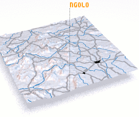 Places with similar names to Ngolo, Angola ::
Disclaimer :: Information on this page comes without warranty of any kind |
||
|
Where is Ngolo? Elevation and coordinates ::
Latitude (lat): 12°53'32"S Longitude (lon): 15°25'27"E
Elevation (approx.): 1632m (map arrows pan, magnifying glasses zoom) |
||
|
Visiting Ngolo? Hotel/Accommodation ::
Book a hotel in Ngolo Travel Guide ::
Buy a travel guide for Angola rental cars ::
car rental offers GPS waypoint ::
download a GPX waypoint (PoI) of Ngolo for your GPS receiver
|
||