|
search place name
|
||
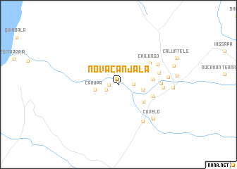
Nova Canjala (Benguela, Angola)Nova Canjala is a town in the Benguela region of Angola. An overview map of the region around Nova Canjala is displayed below.
regional and 3d topo map of Nova Canjala, Angola ::
Nova Canjala airports ::
The nearest airport is BUG - Benguela, located 87.6 km south west of Nova Canjala.
Other airports nearby include PBN - Porto Amboim (142.0 km north), NOV - Huambo (219.8 km south east), Nearby towns ::
Chingo (1.5km west) //
Cauango (2.1km west) //
Laranja (2.3km east) //
Chiuto (3.6km north east) //
Camupa (3.8km west) //
Lalanja (3.8km east) //
Calochapa (4.8km south east) //
Cerâmica (5.3km east) //
Ngangula (5.6km east) //
Chilungo (5.9km north east) //
Cateque (6.5km east) //
Deolinda Rodrigues (6.6km east) //
Cambulaco (6.9km north east) //
Cuvelo (7.0km south east) //
Gica (6.9km east) //
Cuvelo (7.6km south east) //
Hahongo (7.8km east) //
Balabaia (8.5km east) //
Canjala (9.0km east) //
[all distances 'as the bird flies' and approximate] 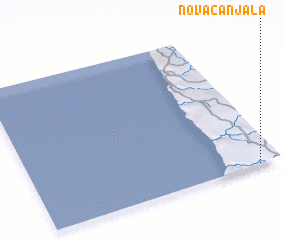 Places with similar names to Nova Canjala, Angola :: Disclaimer :: Information on this page comes without warranty of any kind |
||
|
Where is Nova Canjala? Elevation and coordinates ::
Latitude (lat): 11°59'51"S Longitude (lon): 13°54'55"E
Elevation (approx.): 210m (map arrows pan, magnifying glasses zoom) |
||
|
Visiting Nova Canjala? Hotel/Accommodation ::
Book a hotel in Nova Canjala Travel Guide ::
Buy a travel guide for Angola rental cars ::
car rental offers GPS waypoint ::
download a GPX waypoint (PoI) of Nova Canjala for your GPS receiver
|
||