|
search place name
|
||
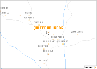
Quiteca Buanda (Uíge, Angola)Quiteca Buanda is a town in the Uíge region of Angola. An overview map of the region around Quiteca Buanda is displayed below.
regional and 3d topo map of Quiteca Buanda, Angola ::
Quiteca Buanda airports ::
The nearest airport is GXG - Negage, located 90.2 km south west of Quiteca Buanda.
Other airports nearby include UGO - Uige (108.9 km west), SSY - M'banza-congo Mbanza Congo (221.6 km north west), Nearby towns ::
Quipaulo (1.8km east) //
Quimaqueta (1.8km east) //
Serrador (2.6km south east) //
Quibula Caxaca (3.7km south) //
Quimuginda (3.7km south) //
Sanza Pombo (4.1km south east) //
Quicuni (4.1km north west) //
Tacabunga (4.1km north west) //
Quissala (5.2km north west) //
Quimatumbi (5.9km south) //
Quibataxe (6.6km south east) //
Quimoiala (7.4km south) //
Monvundo (9.2km north west) //
Ialamo (10.4km north west) //
[all distances 'as the bird flies' and approximate] 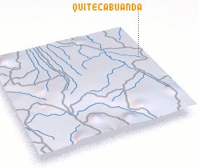 Places with similar names to Quiteca Buanda, Angola ::
// Kotgai Bānda (PK)
Disclaimer :: Information on this page comes without warranty of any kind |
||
|
Where is Quiteca Buanda? Elevation and coordinates ::
Latitude (lat): 7°18'0"S Longitude (lon): 15°58'0"E
Elevation (approx.): 932m (map arrows pan, magnifying glasses zoom) |
||
|
Visiting Quiteca Buanda? Hotel/Accommodation ::
Book a hotel in Quiteca Buanda Travel Guide ::
Buy a travel guide for Angola rental cars ::
car rental offers GPS waypoint ::
download a GPX waypoint (PoI) of Quiteca Buanda for your GPS receiver
|
||