|
search place name
|
||
Dashkerpi ((( Akhuryani Shrjan )), Armenia)Dashkerpi is a town in the (( Akhuryani Shrjan )) region of Armenia. An overview map of the region around Dashkerpi is displayed below.
regional and 3d topo map of Dashkerpi, Armenia ::
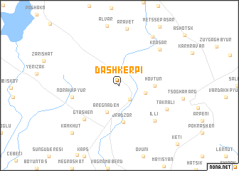
Nearby towns ::
Amasia (2.5km south east) //
Bandivan (3.3km east) //
Aregnadem (4.5km south) //
Hovtun (4.2km east) //
Jradzor (5.8km south) //
Norakhpyur (5.9km west) //
Gtashen (6.8km south west) //
Illi (7.0km south east) //
Taknali (6.7km south east) //
Krasar (7.4km north east) //
Aravet (8.9km north) //
P'ok'r Sepasar (8.6km north east) //
Kamkhut (9.3km south west) //
[all distances 'as the bird flies' and approximate] 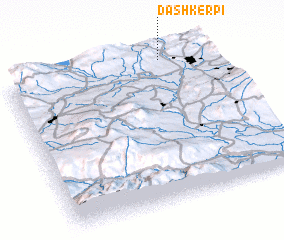 Places with similar names to Dashkerpi, Armenia :: Disclaimer :: Information on this page comes without warranty of any kind |
||
|
Where is Dashkerpi? Elevation and coordinates ::
Latitude (lat): 40°58'0"N Longitude (lon): 43°46'0"E
Elevation (approx.): 1925m (map arrows pan, magnifying glasses zoom) |
||
|
Visiting Dashkerpi? Hotel/Accommodation ::
Book a hotel in Dashkerpi Travel Guide ::
Buy a travel guide for Armenia rental cars ::
car rental offers GPS waypoint ::
download a GPX waypoint (PoI) of Dashkerpi for your GPS receiver
|
||