|
search place name
|
||
Mgart (Alaverdi, Armenia)Mgart is a town in the Alaverdi region of Armenia. An overview map of the region around Mgart is displayed below.
regional and 3d topo map of Mgart, Armenia ::
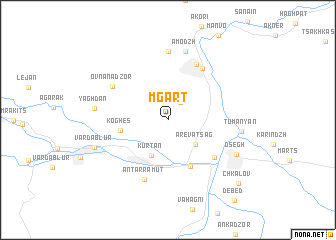
Nearby towns ::
Aygehat (2.3km north east) //
Ardvi (2.5km north east) //
Arevatsag (3.6km south east) //
Kurtʼan (4.2km south) //
Koghes (4.2km west) //
Dzoragyugh (5.5km south) //
Tsatʼer (5.7km south east) //
Odzun (6.4km north east) //
Odzun (6.7km north) //
Antarramut (6.9km south) //
Ovnanadzor (6.0km north west) //
Agvi (7.6km north) //
Amodzh (7.8km north) //
Tʼumanyan (6.3km east) //
Yaghdan (6.3km west) //
Dsegh (7.0km south east) //
Vardablur (6.9km south west) //
Chʼkalov (9.2km south east) //
[all distances 'as the bird flies' and approximate] 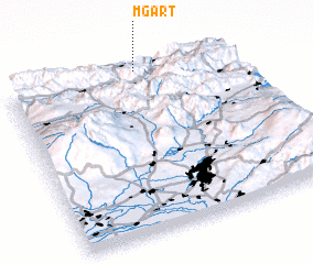 Places with similar names to Mgart, Armenia ::
Disclaimer :: Information on this page comes without warranty of any kind |
||
|
Where is Mgart? Elevation and coordinates ::
Latitude (lat): 40°59'53"N Longitude (lon): 44°34'57"E
Elevation (approx.): 1404m (map arrows pan, magnifying glasses zoom) |
||
|
Visiting Mgart? Hotel/Accommodation ::
Book a hotel in Mgart Travel Guide ::
Buy a travel guide for Armenia rental cars ::
car rental offers GPS waypoint ::
download a GPX waypoint (PoI) of Mgart for your GPS receiver
|
||