|
search place name
|
||
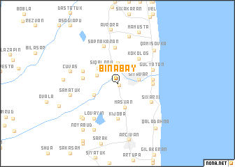
Binabǝy (Astara, Azerbaijan)Binabǝy is a town in the Astara region of Azerbaijan. An overview map of the region around Binabǝy is displayed below.
regional and 3d topo map of Binabǝy, Azerbaijan ::
Binabǝy airports ::
The nearest airport is RAS - Rasht, located 155.9 km south east of Binabǝy.
Other airports nearby include BAK - Baku Heydar Aliyev (234.4 km north east), RZR - Ramsar (247.9 km south east), Nearby towns ::
Tǝngǝrud (0.4km south) //
Pensǝr (3.3km north) //
Sıqalonu (3.0km north west) //
Siyavar (2.7km east) //
Siyaku (2.8km north west) //
Maşxan (3.8km south) //
Vaqo (3.4km north west) //
Tülǝküvan (3.4km south west) //
Kokolos (4.8km north east) //
Rinǝ (4.3km west) //
Şiyǝkǝran (4.3km east) //
Şahağac (4.4km east) //
Kijoba (5.6km south) //
Telman (5.7km north) //
Marzǝsǝ (4.7km north west) //
Gülyatan (4.9km north east) //
Şıxarxı (5.2km south east) //
Sǝpnǝkǝran (6.1km north) //
Lövǝyin (6.3km south west) //
Tǝzǝkǝnd (7.6km north) //
Şǝmǝtük (6.1km west) //
Çuvaş (6.1km west) //
Ojakǝran (7.1km south west) //
Burzubǝnd (7.0km south west) //
Qamışovka (7.0km north east) //
Deqadi (8.0km south) //
Miki (6.7km west) //
Avrora (8.6km north) //
Mamusta (8.7km north) //
[all distances 'as the bird flies' and approximate] 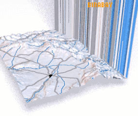 Places with similar names to Binabǝy, Azerbaijan ::
Disclaimer :: Information on this page comes without warranty of any kind |
||
|
Where is Binabǝy? Elevation and coordinates ::
Latitude (lat): 38°35'0"N Longitude (lon): 48°49'0"E
Elevation (approx.): -9m (map arrows pan, magnifying glasses zoom) |
||
|
Visiting Binabǝy? Hotel/Accommodation ::
Book a hotel in Binabǝy Travel Guide ::
Buy a travel guide for Azerbaijan rental cars ::
car rental offers GPS waypoint ::
download a GPX waypoint (PoI) of Binabǝy for your GPS receiver
|
||