|
search place name
|
||
Dǝstǝfur (Daşkǝsǝn, Azerbaijan)Dǝstǝfur is a town in the Daşkǝsǝn region of Azerbaijan. An overview map of the region around Dǝstǝfur is displayed below.
regional and 3d topo map of Dǝstǝfur, Azerbaijan ::
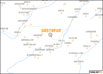
Nearby towns ::
Əhmǝdli (2.7km north west) //
Dardǝrǝ (2.8km north west) //
Qıyıqlı (3.1km north east) //
Almalı (3.8km south east) //
Zinzagal (4.2km south) //
Kollu (3.6km south east) //
Muşavak (3.8km west) //
Yëlkullar (4.9km south west) //
Gedǝmiş (5.5km south) //
Çanaqçı (5.2km south west) //
Çıraqlı (5.5km south east) //
Şahkǝrǝm (6.4km south west) //
Tulalar (6.1km east) //
Qaratağlar (7.0km south west) //
Mollahǝsǝnli (7.3km north west) //
Qaraqullar (6.9km west) //
Zivlan (8.6km south west) //
Mirzik (9.1km north) //
Alakhanchally (8.7km south west) //
Zurnabad (8.6km north east) //
[all distances 'as the bird flies' and approximate] 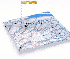 Places with similar names to Dǝstǝfur, Azerbaijan ::
Disclaimer :: Information on this page comes without warranty of any kind |
||
|
Where is Dǝstǝfur? Elevation and coordinates ::
Latitude (lat): 40°26'59"N Longitude (lon): 46°10'15"E
Elevation (approx.): 1404m (map arrows pan, magnifying glasses zoom) |
||
|
Visiting Dǝstǝfur? Hotel/Accommodation ::
Book a hotel in Dǝstǝfur Travel Guide ::
Buy a travel guide for Azerbaijan rental cars ::
car rental offers GPS waypoint ::
download a GPX waypoint (PoI) of Dǝstǝfur for your GPS receiver
|
||