|
search place name
|
||
Hücü (Lerik, Azerbaijan)Hücü is a town in the Lerik region of Azerbaijan. An overview map of the region around Hücü is displayed below.
regional and 3d topo map of Hücü, Azerbaijan ::

Hücü airports ::
The nearest airport is RAS - Rasht, located 179.8 km south east of Hücü.
Other airports nearby include BAK - Baku Heydar Aliyev (229.6 km north east), Nearby towns ::
Bibinoni (2.1km north west) //
Davaradibi (2.4km south east) //
Qǝlǝbin (4.5km south) //
Tǝndul (4.2km south west) //
Haran (4.7km north) //
Tikǝbǝnd (4.3km south west) //
Khush (5.7km north) //
Zǝrikümǝco (5.2km south east) //
Almu (5.1km north west) //
Zardoni (5.4km west) //
Körnǝdi (5.4km west) //
Siyov (7.0km south) //
Əliabad (6.8km south west) //
Qılqlov (7.4km south) //
Cǝngǝnǝvud (6.3km north west) //
Baliton (7.5km north) //
Hovil (7.7km south) //
Akuşapeştǝ (7.7km south) //
Veri (7.1km south west) //
Vizǝzǝmin (7.2km north west) //
Küsǝkǝran (7.5km south west) //
Şivlǝ (8.4km north) //
Spyereqon (7.6km north west) //
Dangyaband (7.5km north east) //
Bürsümlü (9.1km south east) //
Bobogil (9.9km north west) //
[all distances 'as the bird flies' and approximate] 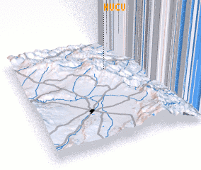 Places with similar names to Hücü, Azerbaijan ::
Disclaimer :: Information on this page comes without warranty of any kind |
||
|
Where is Hücü? Elevation and coordinates ::
Latitude (lat): 38°43'58"N Longitude (lon): 48°35'30"E
Elevation (approx.): 656m (map arrows pan, magnifying glasses zoom) |
||
|
Visiting Hücü? Hotel/Accommodation ::
Book a hotel in Hücü Travel Guide ::
Buy a travel guide for Azerbaijan rental cars ::
car rental offers GPS waypoint ::
download a GPX waypoint (PoI) of Hücü for your GPS receiver
|
||