|
search place name
|
||
Köhnǝkǝnd (Laçın, Azerbaijan)Köhnǝkǝnd is a town in the Laçın region of Azerbaijan. An overview map of the region around Köhnǝkǝnd is displayed below.
regional and 3d topo map of Köhnǝkǝnd, Azerbaijan ::

Köhnǝkǝnd airports ::
The nearest airport is TBZ - Tabriz Intl, located 171.2 km south of Köhnǝkǝnd.
Nearby towns ::
Qışlaq (3.2km south) //
Xumarta (3.3km south west) //
İrçan (3.0km west) //
Çǝmbǝrxaç (4.0km west) //
Dǝyhan (6.9km south west) //
Suarası (8.1km south) //
Arpagǝdik (8.5km south) //
Turşsu (8.0km north west) //
Tarkhanly (9.4km south west) //
Khanalar (10.3km south west) //
[all distances 'as the bird flies' and approximate] 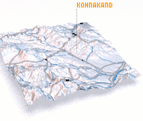 Places with similar names to Köhnǝkǝnd, Azerbaijan ::
// Güneykǝnd (AZ)
// Cangandí (PA)
// Canquintú (PA)
// Kānī Kand (IQ)
// Kāwnagūnd (IQ)
// Kunegundow (PL)
// Güneykent (TR)
// Gunagunīt (ET)
// Gaon Kāndia (BD)
// Kuniākāndi (BD)
Disclaimer :: Information on this page comes without warranty of any kind |
||
|
Where is Köhnǝkǝnd? Elevation and coordinates ::
Latitude (lat): 39°37'56"N Longitude (lon): 46°42'11"E
Elevation (approx.): 1664m (map arrows pan, magnifying glasses zoom) |
||
|
Visiting Köhnǝkǝnd? Hotel/Accommodation ::
Book a hotel in Köhnǝkǝnd Travel Guide ::
Buy a travel guide for Azerbaijan rental cars ::
car rental offers GPS waypoint ::
download a GPX waypoint (PoI) of Köhnǝkǝnd for your GPS receiver
|
||