|
search place name
|
||
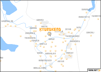
Kyurdkend (Azerbaijan)Kyurdkend is a town in Azerbaijan. An overview map of the region around Kyurdkend is displayed below.
regional and 3d topo map of Kyurdkend, Azerbaijan ::
Kyurdkend airports ::
The nearest airport is VAN - Van, located 186.8 km south west of Kyurdkend.
Other airports nearby include TBZ - Tabriz Intl (193.4 km south east), Nearby towns ::
Korchulu (1.4km west) //
Şǝrur (2.4km south) //
Şǝhriyar (2.5km south west) //
Maxta (2.9km north west) //
Düdǝngǝ (2.6km east) //
Çomaxtur (4.0km south) //
Charchibogan (4.0km south) //
Karaburdzh (3.4km north west) //
Shoţlū (4.5km south west) //
Cǝlilkǝnd (3.8km east) //
Sarkhanly (3.9km east) //
Qarxun (4.2km south east) //
Muganly (4.7km south west) //
Arbatan (5.6km south) //
Sovetabad (5.7km south) //
Kerimbeyli (4.7km north west) //
Khaladzh (5.7km south) //
Muğancıq Müslüm (4.7km south east) //
Dǝmirçi (5.6km north west) //
Yengicǝ (5.0km south west) //
Ağǝmǝd (5.1km west) //
Tazakend (5.7km north west) //
Alyshar (5.7km south west) //
Kyurdchullu (5.7km south west) //
Yuxarı Aralıq (6.2km south east) //
Zeyvǝ (5.3km east) //
Siyaqut (5.8km south east) //
Zanganeh (5.7km west) //
Babaki (7.4km south) //
[all distances 'as the bird flies' and approximate] 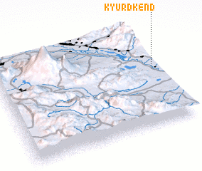 Places with similar names to Kyurdkend, Azerbaijan :: Disclaimer :: Information on this page comes without warranty of any kind |
||
|
Where is Kyurdkend? Elevation and coordinates ::
Latitude (lat): 39°34'0"N Longitude (lon): 44°58'0"E
Elevation (approx.): 804m (map arrows pan, magnifying glasses zoom) |
||
|
Visiting Kyurdkend? Hotel/Accommodation ::
Book a hotel in Kyurdkend Travel Guide ::
Buy a travel guide for Azerbaijan rental cars ::
car rental offers GPS waypoint ::
download a GPX waypoint (PoI) of Kyurdkend for your GPS receiver
|
||