|
search place name
|
||
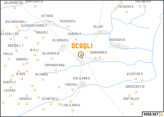
Ocaqlı (Cǝlilabad, Azerbaijan)Ocaqlı is a town in the Cǝlilabad region of Azerbaijan. An overview map of the region around Ocaqlı is displayed below.
regional and 3d topo map of Ocaqlı, Azerbaijan ::
Ocaqlı airports ::
The nearest airport is BAK - Baku Heydar Aliyev, located 188.6 km north east of Ocaqlı.
Other airports nearby include RAS - Rasht (235.5 km south east), Nearby towns ::
Andreyevka (2.3km east) //
Sabirabad (3.1km east) //
Zubanly (4.7km north) //
Əliqasımlı (4.7km north west) //
Cǝlilabad (5.6km south) //
Sǝrhǝdabad (5.4km south west) //
Şilǝvǝngǝ (5.4km west) //
Allar (7.0km north east) //
Farzali (7.3km south) //
Tǝzǝkǝnd (7.8km north) //
Bashsyz (7.7km south west) //
Pokrovka (7.1km north east) //
Bǝdirli (8.4km north west) //
Üçtǝpǝ (10.5km north west) //
[all distances 'as the bird flies' and approximate] 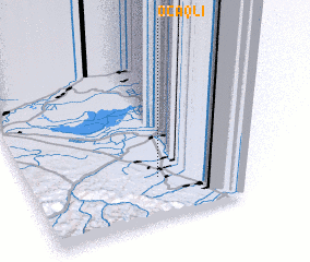 Places with similar names to Ocaqlı, Azerbaijan ::
Disclaimer :: Information on this page comes without warranty of any kind |
||
|
Where is Ocaqlı? Elevation and coordinates ::
Latitude (lat): 39°15'33"N Longitude (lon): 48°29'50"E
Elevation (approx.): 19m (map arrows pan, magnifying glasses zoom) |
||
|
Visiting Ocaqlı? Hotel/Accommodation ::
Book a hotel in Ocaqlı Travel Guide ::
Buy a travel guide for Azerbaijan rental cars ::
car rental offers GPS waypoint ::
download a GPX waypoint (PoI) of Ocaqlı for your GPS receiver
|
||