|
search place name
|
||
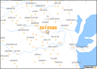
Şatıroba (Masallı, Azerbaijan)Şatıroba is a town in the Masallı region of Azerbaijan. An overview map of the region around Şatıroba is displayed below.
regional and 3d topo map of Şatıroba, Azerbaijan ::
Şatıroba airports ::
The nearest airport is RAS - Rasht, located 192.9 km south east of Şatıroba.
Other airports nearby include BAK - Baku Heydar Aliyev (206.0 km north east), Nearby towns ::
Boradigah (1.8km north west) //
Hişgǝdǝrǝ (2.2km west) //
Zovlya (3.2km south) //
Molalan (2.9km south east) //
Mahmudavar (3.3km south west) //
Sirabil (3.7km north) //
Tyuklya (3.7km west) //
Türkoba (4.7km south west) //
Mishkemi (4.2km south west) //
Boladı (4.7km south east) //
Bǝdǝlan (4.8km north west) //
Sǝrçuvar (5.4km north east) //
Ashurlu (5.1km north west) //
Qǝzvinoba (4.6km west) //
Babaser (5.1km north west) //
Xıl (6.0km north) //
Şağlasǝr (6.1km south) //
Separadi (6.1km south) //
Qumbaşı (5.5km north east) //
Rudǝkǝnar (6.4km south west) //
Miyanku (5.7km south west) //
Qızılavar (6.5km north west) //
Tüklǝ (6.6km south west) //
Kharkhatan (7.6km south) //
Nǝzǝroba (6.7km south west) //
Kazımlı Cil (8.0km south) //
Babakyudzha (7.4km north west) //
Göyǝçöl (8.5km north) //
Miandy (6.8km west) //
[all distances 'as the bird flies' and approximate]  Places with similar names to Şatıroba, Azerbaijan ::
Disclaimer :: Information on this page comes without warranty of any kind |
||
|
Where is Şatıroba? Elevation and coordinates ::
Latitude (lat): 38°55'4"N Longitude (lon): 48°43'32"E
Elevation (approx.): -23m (map arrows pan, magnifying glasses zoom) |
||
|
Visiting Şatıroba? Hotel/Accommodation ::
Book a hotel in Şatıroba Travel Guide ::
Buy a travel guide for Azerbaijan rental cars ::
car rental offers GPS waypoint ::
download a GPX waypoint (PoI) of Şatıroba for your GPS receiver
|
||