|
search place name
|
||
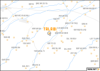
Talabı (Quba, Azerbaijan)Talabı is a town in the Quba region of Azerbaijan. An overview map of the region around Talabı is displayed below.
regional and 3d topo map of Talabı, Azerbaijan ::
Talabı airports ::
The nearest airport is BAK - Baku Heydar Aliyev, located 146.8 km south east of Talabı.
Other airports nearby include MCX - Makhachkala Uytash (191.3 km north west), Nearby towns ::
Ashagy Kharasha (2.6km north east) //
Sırt Çiçi (3.8km south) //
Qorxmazoba (3.3km east) //
Əspǝrǝsti (3.3km east) //
Sǝbǝtlǝr (4.7km south) //
Gǝdikqışlaq (3.7km north east) //
Gasaneri (3.8km south east) //
Kardash (4.1km north west) //
Zǝrqava (4.3km south east) //
Küçay (5.8km north) //
Rǝzǝlǝr (6.0km south) //
Çiçi (6.6km south) //
Qamqam (5.3km south west) //
Dǝhnǝ (5.2km west) //
Tǝngǝalti (7.3km south west) //
Pirvahid (7.6km north east) //
Gilyanov (6.4km east) //
Püstǝqasım (6.4km west) //
Daşlıyataq (7.1km north east) //
Gilvar (7.7km south east) //
Rustov (6.9km west) //
Talabıqışlaq (7.9km north east) //
Yekdar (7.5km south west) //
İkinci Nügǝdi (8.2km north west) //
Zeyva (10.0km south east) //
[all distances 'as the bird flies' and approximate] 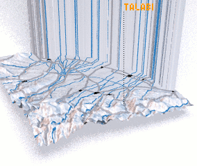 Places with similar names to Talabı, Azerbaijan ::
Disclaimer :: Information on this page comes without warranty of any kind |
||
|
Where is Talabı? Elevation and coordinates ::
Latitude (lat): 41°16'3"N Longitude (lon): 48°39'38"E
Elevation (approx.): 637m (map arrows pan, magnifying glasses zoom) |
||
|
Visiting Talabı? Hotel/Accommodation ::
Book a hotel in Talabı Travel Guide ::
Buy a travel guide for Azerbaijan rental cars ::
car rental offers GPS waypoint ::
download a GPX waypoint (PoI) of Talabı for your GPS receiver
|
||