|
search place name
|
||
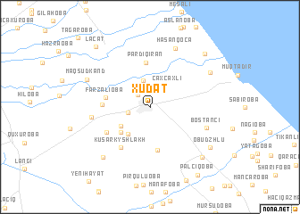
Xudat (Xaçmaz, Azerbaijan)Xudat is a town in the Xaçmaz region of Azerbaijan. An overview map of the region around Xudat is displayed below.
regional and 3d topo map of Xudat, Azerbaijan ::
Xudat airports ::
The nearest airport is MCX - Makhachkala Uytash, located 157.1 km north west of Xudat.
Other airports nearby include BAK - Baku Heydar Aliyev (172.5 km south east), Nearby towns ::
Şollar (1.9km north west) //
Köhnǝ Xudat (2.2km west) //
Susayqışlaq (3.4km north) //
Çaxçaxlı (3.2km north east) //
Ağaverdioba (3.9km south west) //
Bala Qusarqışlaq (3.6km south west) //
Seyidlǝr (4.1km south west) //
Hǝsǝnqala (5.3km south) //
Pǝrdiqıran (5.6km north) //
Fǝrzǝlioba (4.4km west) //
İdrisoba (4.5km west) //
Kusarkyshlakh (5.7km south west) //
Digahoba (5.2km south west) //
Shumagir (5.6km west) //
Bostançı (5.9km south east) //
Hǝsǝnqoca (7.7km north) //
Hacımǝmmǝdoba (7.6km south west) //
Vǝlǝmir (7.0km north east) //
Maqsudkǝnd (6.8km north west) //
Qusarçay (7.9km south east) //
Obudzhlu (7.5km south east) //
Xuray (8.4km north east) //
Lǝcǝt (9.1km north west) //
Palçıqoba (9.5km south east) //
[all distances 'as the bird flies' and approximate]  Places with similar names to Xudat, Azerbaijan ::
Disclaimer :: Information on this page comes without warranty of any kind |
||
|
Where is Xudat? Elevation and coordinates ::
Latitude (lat): 41°37'41"N Longitude (lon): 48°40'58"E
Elevation (approx.): 43m (map arrows pan, magnifying glasses zoom) |
||
|
Visiting Xudat? Hotel/Accommodation ::
Book a hotel in Xudat Travel Guide ::
Buy a travel guide for Azerbaijan rental cars ::
car rental offers GPS waypoint ::
download a GPX waypoint (PoI) of Xudat for your GPS receiver
|
||