|
search place name
|
||
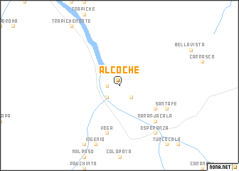
Alcoche (La Paz, Bolivia)Alcoche is a town in the La Paz region of Bolivia. An overview map of the region around Alcoche is displayed below.
regional and 3d topo map of Alcoche, Bolivia ::
Alcoche airports ::
The nearest airport is LPB - La Paz El Alto Intl, located 106.1 km south west of Alcoche.
Other airports nearby include CBB - Cochabamba Jorge Wilsterman (248.1 km south east), Nearby towns ::
Zongochoro (1.8km west) //
Asunta (2.6km south west) //
Tutirihuara (2.6km south east) //
Chacaltaya (6.5km south east) //
Vega (7.6km south) //
Naranjacala (7.7km south east) //
Santa Fe (8.0km south east) //
Esperanza (9.1km south east) //
[all distances 'as the bird flies' and approximate]  Places with similar names to Alcoche, Bolivia ::
// Alqōsh (IQ)
// Allçaush (AL)
// Al Kushḩ (EG)
// Algach (RU)
// Ali Kachha (PK)
// Aloacocha (PE)
// Ayllucucho (PE)
// Alakshay (RU)
// Algachi (RU)
// Al Qash‘ah (OM)
Disclaimer :: Information on this page comes without warranty of any kind |
||
|
Where is Alcoche? Elevation and coordinates ::
Latitude (lat): 15°42'0"S Longitude (lon): 67°40'0"W
Elevation (approx.): 966m (map arrows pan, magnifying glasses zoom) |
||
|
Visiting Alcoche? Hotel/Accommodation ::
Book a hotel in Alcoche Travel Guide ::
Buy a travel guide for Bolivia rental cars ::
car rental offers GPS waypoint ::
download a GPX waypoint (PoI) of Alcoche for your GPS receiver
|
||