|
search place name
|
||
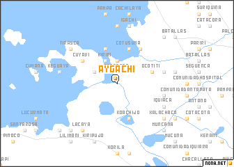
Aygachi (La Paz, Bolivia)Aygachi is a town in the La Paz region of Bolivia. An overview map of the region around Aygachi is displayed below.
regional and 3d topo map of Aygachi, Bolivia ::
Aygachi airports ::
The nearest airport is LPB - La Paz El Alto Intl, located 48.1 km east of Aygachi.
Other airports nearby include JUL - Juliaca (192.8 km north west), TCQ - Tacna Coronel Carlos Ciriani Santa Rosa Intl (256.9 km south west), ARI - Arica Chacalluta (285.7 km south west), Nearby towns ::
Tacanoca (1.9km north) //
Yayes (2.6km north east) //
Kesanani (3.7km north) //
Cachilaya (3.7km north) //
Kohana (4.0km north west) //
Kiriri (4.1km north west) //
Carapata (5.8km north) //
Ocotiti (5.6km east) //
Koachijo (5.8km south) //
Cotusuma (5.8km north) //
Chichilaya (6.6km north east) //
Cuyavi (6.5km north west) //
Cahuiña (7.4km east) //
Chiarpata (7.4km east) //
Iquiaca (8.0km south east) //
Lacaya (9.1km south west) //
Patapatani (9.0km north west) //
Tirasca (9.0km north west) //
Kalachaca (9.0km south east) //
Kalachaca (10.3km south west) //
Muncaña (10.3km south east) //
Batalla (10.3km north east) //
[all distances 'as the bird flies' and approximate] 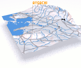 Places with similar names to Aygachi, Bolivia ::
Disclaimer :: Information on this page comes without warranty of any kind |
||
|
Where is Aygachi? Elevation and coordinates ::
Latitude (lat): 16°22'0"S Longitude (lon): 68°37'0"W
Elevation (approx.): 3827m (map arrows pan, magnifying glasses zoom) |
||
|
Visiting Aygachi? Hotel/Accommodation ::
Book a hotel in Aygachi Travel Guide ::
Buy a travel guide for Bolivia rental cars ::
car rental offers GPS waypoint ::
download a GPX waypoint (PoI) of Aygachi for your GPS receiver
|
||