|
search place name
|
||
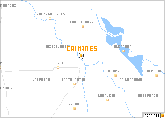
Caimanes (Santa Cruz, Bolivia)Caimanes is a town in the Santa Cruz region of Bolivia. An overview map of the region around Caimanes is displayed below.
regional and 3d topo map of Caimanes, Bolivia ::
Caimanes airports ::
The nearest airport is VVI - Santa Cruz Viru Viru Intl, located 60.7 km south of Caimanes.
Nearby towns ::
Santa Martha (5.8km south) //
El Fortín (5.6km west) //
Sixto Suárez (5.6km west) //
Chane Bedoya (7.4km north) //
Puerto Zambrana (7.7km south west) //
Pizarro (8.0km south east) //
[all distances 'as the bird flies' and approximate] 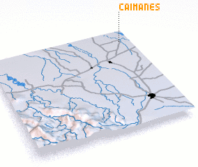 Places with similar names to Caimanes, Bolivia ::
Disclaimer :: Information on this page comes without warranty of any kind |
||
|
Where is Caimanes? Elevation and coordinates ::
Latitude (lat): 17°6'0"S Longitude (lon): 63°4'0"W
Elevation (approx.): 253m (map arrows pan, magnifying glasses zoom) |
||
|
Visiting Caimanes? Hotel/Accommodation ::
Book a hotel in Caimanes Travel Guide ::
Buy a travel guide for Bolivia rental cars ::
car rental offers GPS waypoint ::
download a GPX waypoint (PoI) of Caimanes for your GPS receiver
|
||