|
search place name
|
||
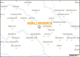
Huaillarinorca (Potosí, Bolivia)Huaillarinorca is a town in the Potosí region of Bolivia. An overview map of the region around Huaillarinorca is displayed below.
regional and 3d topo map of Huaillarinorca, Bolivia ::
Huaillarinorca airports ::
The nearest airport is TJA - Tarija Capitan Oriel Lea Plaza, located 179.4 km east of Huaillarinorca.
Nearby towns ::
Alpahuasi (3.4km east) //
Chaupiñarca (4.1km south east) //
Santa Isabel (4.1km south west) //
Culi Culi (5.1km south east) //
Juriyoc (5.1km north west) //
Collpa (5.1km south west) //
Chalviri (5.5km east) //
Viluyo (6.4km north east) //
Chanchiluyoc (6.5km south west) //
Saroanza (7.6km north) //
Yana Orko (7.8km south east) //
Huracancha (8.2km south east) //
Tibuinto (7.8km north west) //
[all distances 'as the bird flies' and approximate] 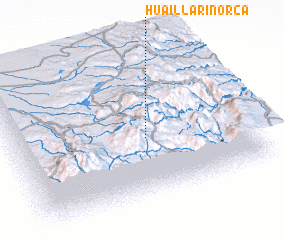 Places with similar names to Huaillarinorca, Bolivia :: Disclaimer :: Information on this page comes without warranty of any kind |
||
|
Where is Huaillarinorca? Elevation and coordinates ::
Latitude (lat): 21°35'0"S Longitude (lon): 66°26'0"W
Elevation (approx.): 4453m (map arrows pan, magnifying glasses zoom) |
||
|
Visiting Huaillarinorca? Hotel/Accommodation ::
Book a hotel in Huaillarinorca Travel Guide ::
Buy a travel guide for Bolivia rental cars ::
car rental offers GPS waypoint ::
download a GPX waypoint (PoI) of Huaillarinorca for your GPS receiver
|
||