|
search place name
|
||
La Cancha (Potosí, Bolivia)La Cancha is a town in the Potosí region of Bolivia. An overview map of the region around La Cancha is displayed below.
regional and 3d topo map of La Cancha, Bolivia ::

La Cancha airports ::
The nearest airport is POI - Potosi Capitan Nicolas Rojas, located 53.8 km west of La Cancha.
Other airports nearby include SRE - Sucre Juana Azurduy De Padilla (67.9 km north), TJA - Tarija Capitan Oriel Lea Plaza (221.3 km south), Nearby towns ::
Concepción (0.0km north) //
Molle Punco (1.9km south) //
Esquiri (2.5km south) //
San Sebastián (2.5km north east) //
San Roque (4.0km north west) //
San Jacinto (4.1km north east) //
San Pedro (5.6km north) //
Yanaccacca (6.6km south west) //
Yanahuara (6.6km south west) //
Moco Pata (6.6km south west) //
Suchiri (6.6km south west) //
Metina (7.2km east) //
Balconcillo Alomuya (7.6km north west) //
Canchacancha Uchilla (7.9km north west) //
Lequesani (8.3km west) //
Chinoli (9.1km south west) //
[all distances 'as the bird flies' and approximate] 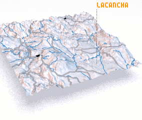 Places with similar names to La Cancha, Bolivia ::
// Lokinach (ET)
// Laukinčiai (LT)
// La Concha (CU)
// La Concha (ES)
// La Concha (ES)
// La Guancha (ES)
// Lukinichi (RU)
// Licancheo (CL)
// La Quincha (CO)
// La Concha (MX)
Disclaimer :: Information on this page comes without warranty of any kind |
||
|
Where is La Cancha? Elevation and coordinates ::
Latitude (lat): 19°37'0"S Longitude (lon): 65°13'0"W
Elevation (approx.): 2708m (map arrows pan, magnifying glasses zoom) |
||
|
Visiting La Cancha? Hotel/Accommodation ::
Book a hotel in La Cancha Travel Guide ::
Buy a travel guide for Bolivia rental cars ::
car rental offers GPS waypoint ::
download a GPX waypoint (PoI) of La Cancha for your GPS receiver
|
||