|
search place name
|
||
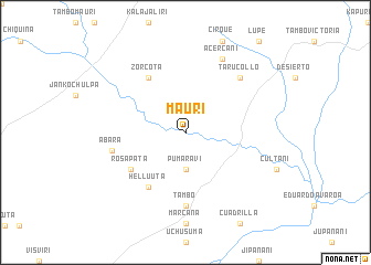
Mauri (La Paz, Bolivia)Mauri is a town in the La Paz region of Bolivia. An overview map of the region around Mauri is displayed below.
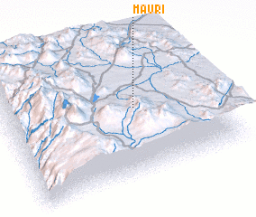
regional and 3d topo map of Mauri, Bolivia ::
Mauri airports ::
The nearest airport is TCQ - Tacna Coronel Carlos Ciriani Santa Rosa Intl, located 116.2 km south west of Mauri.
Other airports nearby include ARI - Arica Chacalluta (141.9 km south west), LPB - La Paz El Alto Intl (163.6 km north east), JUL - Juliaca (236.9 km north), Nearby towns ::
 Places with similar names to Mauri, Bolivia ::
Disclaimer :: Information on this page comes without warranty of any kind |
||
|
Where is Mauri? Elevation and coordinates ::
Latitude (lat): 17°28'0"S Longitude (lon): 69°22'0"W
Elevation (approx.): 4029m (map arrows pan, magnifying glasses zoom) |
||
|
Visiting Mauri? Hotel/Accommodation ::
Book a hotel in Mauri Travel Guide ::
Buy a travel guide for Bolivia rental cars ::
car rental offers GPS waypoint ::
download a GPX waypoint (PoI) of Mauri for your GPS receiver
|
||