|
search place name
|
||
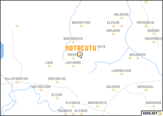
Motacutú (Santa Cruz, Bolivia)Motacutú is a town in the Santa Cruz region of Bolivia. An overview map of the region around Motacutú is displayed below.
regional and 3d topo map of Motacutú, Bolivia ::
Motacutú airports ::
The nearest airport is VVI - Santa Cruz Viru Viru Intl, located 68.3 km south east of Motacutú.
Other airports nearby include SRE - Sucre Juana Azurduy De Padilla (248.8 km south west), Nearby towns ::
San Rafael (1.8km west) //
Nieves (1.8km west) //
Las Tapas (2.6km south west) //
Añez (4.1km north west) //
San Lorenzo (4.1km north west) //
Santa Rita (4.0km north east) //
Buen Retiro (7.4km north) //
Lidia (7.3km west) //
San Carlos (7.7km south west) //
San José (9.0km north east) //
Dolores (10.2km south east) //
El Pilar (10.2km north east) //
[all distances 'as the bird flies' and approximate]  Places with similar names to Motacutú, Bolivia ::
// Meadowgate (US)
// Mitakáta (GR)
// Maytiguid (PH)
// Madaket (US)
// Meadow Gate (US)
// Mādkāti (BD)
// Mātikāta (BD)
// Mātikāta (BD)
// Mātikāta (BD)
// Mātikāta (BD)
Disclaimer :: Information on this page comes without warranty of any kind |
||
|
Where is Motacutú? Elevation and coordinates ::
Latitude (lat): 17°21'0"S Longitude (lon): 63°42'0"W
Elevation (approx.): 301m (map arrows pan, magnifying glasses zoom) |
||
|
Visiting Motacutú? Hotel/Accommodation ::
Book a hotel in Motacutú Travel Guide ::
Buy a travel guide for Bolivia rental cars ::
car rental offers GPS waypoint ::
download a GPX waypoint (PoI) of Motacutú for your GPS receiver
|
||