|
search place name
|
||
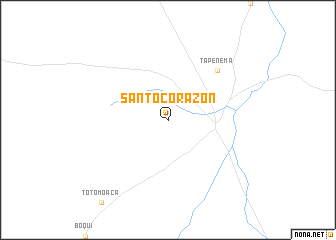
Santo Corazón (Santa Cruz, Bolivia)Santo Corazón is a town in the Santa Cruz region of Bolivia. An overview map of the region around Santo Corazón is displayed below.
regional and 3d topo map of Santo Corazón, Bolivia ::
Santo Corazón airports ::
The nearest airport is PSZ - Puerto Suarez Tte De Av Salvador Ogaya G, located 154.5 km south east of Santo Corazón.
Other airports nearby include CMG - Corumba Intl (168.6 km south east), Nearby towns ::
Tapenema (7.7km north east) //
[all distances 'as the bird flies' and approximate] 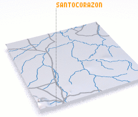 Places with similar names to Santo Corazón, Bolivia ::
// Saint-Gourson (FR)
Disclaimer :: Information on this page comes without warranty of any kind |
||
|
Where is Santo Corazón? Elevation and coordinates ::
Latitude (lat): 17°59'0"S Longitude (lon): 58°51'0"W
Elevation (approx.): 284m (map arrows pan, magnifying glasses zoom) |
||
|
Visiting Santo Corazón? Hotel/Accommodation ::
Book a hotel in Santo Corazón Travel Guide ::
Buy a travel guide for Bolivia rental cars ::
car rental offers GPS waypoint ::
download a GPX waypoint (PoI) of Santo Corazón for your GPS receiver
|
||