|
search place name
|
||
Tabla Huasi (Potosí, Bolivia)Tabla Huasi is a town in the Potosí region of Bolivia. An overview map of the region around Tabla Huasi is displayed below.
regional and 3d topo map of Tabla Huasi, Bolivia ::
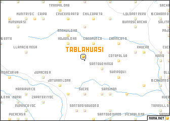
Tabla Huasi airports ::
The nearest airport is TJA - Tarija Capitan Oriel Lea Plaza, located 148.3 km east of Tabla Huasi.
Other airports nearby include BJO - Bermejo (231.5 km south east), ORA - Oran (257.0 km south east), Nearby towns ::
Atuloni (4.1km north east) //
Carapunco (4.1km north east) //
Santo Domingo (3.9km south east) //
Mojonloma (5.1km north west) //
Anahuiloma (6.5km north west) //
Cotafalda (6.9km east) //
Churquiayoc (7.4km north) //
Sucre (7.4km south) //
Jatumanloma (7.6km south west) //
Suripoqui (7.8km south east) //
Carnicota (7.8km north east) //
Candelaria (8.2km south east) //
Piedra Blanca (8.2km south west) //
San Simón (9.0km south east) //
[all distances 'as the bird flies' and approximate] 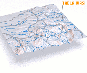 Places with similar names to Tabla Huasi, Bolivia ::
// Tablahuasi (BO)
Disclaimer :: Information on this page comes without warranty of any kind |
||
|
Where is Tabla Huasi? Elevation and coordinates ::
Latitude (lat): 21°33'0"S Longitude (lon): 66°8'0"W
Elevation (approx.): 4137m (map arrows pan, magnifying glasses zoom) |
||
|
Visiting Tabla Huasi? Hotel/Accommodation ::
Book a hotel in Tabla Huasi Travel Guide ::
Buy a travel guide for Bolivia rental cars ::
car rental offers GPS waypoint ::
download a GPX waypoint (PoI) of Tabla Huasi for your GPS receiver
|
||