|
search place name
|
||
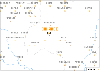
Bakambé (Cameroon)Bakambé is a town in Cameroon. An overview map of the region around Bakambé is displayed below.
regional and 3d topo map of Bakambé, Cameroon ::
Bakambé airports ::
The nearest airport is BFX - Bafoussam, located 57.7 km north of Bakambé.
Other airports nearby include FOM - Foumban Nkounja (89.2 km north east), BPC - Bamenda (111.7 km north), DLA - Douala (126.3 km south west), TKC - Tiko (141.2 km south west), Nearby towns ::
Fopouanga (2.6km south west) //
Fondjanti (3.7km north) //
Ndotoron (4.1km south east) //
Balam (5.8km east) //
Bakouini (6.7km south west) //
Fontsinga (6.7km north west) //
Sohok (8.3km south east) //
Ndoto (8.3km south east) //
Bagouaka (8.3km south west) //
Ngaleu (9.3km north west) //
Bakondji (10.5km north west) //
[all distances 'as the bird flies' and approximate] 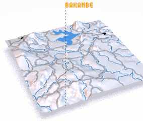 Places with similar names to Bakambé, Cameroon ::
// Bougma (MA)
// Bou Goummou (MA)
// Bou Goummou (MA)
// Bagam (CM)
// Bagma (CM)
// Baïgom (CM)
// Bakem (CM)
// Bakem (CM)
// Bakumba (CM)
// Bakumba (CM)
Disclaimer :: Information on this page comes without warranty of any kind |
||
|
Where is Bakambé? Elevation and coordinates ::
Latitude (lat): 5°2'0"N Longitude (lon): 10°13'0"E
Elevation (approx.): 687m (map arrows pan, magnifying glasses zoom) |
||
|
Visiting Bakambé? Hotel/Accommodation ::
Book a hotel in Bakambé Travel Guide ::
Buy a travel guide for Cameroon rental cars ::
car rental offers GPS waypoint ::
download a GPX waypoint (PoI) of Bakambé for your GPS receiver
|
||