|
search place name
|
||
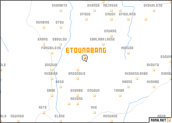
Etounabang (Cameroon)Etounabang is a town in Cameroon. An overview map of the region around Etounabang is displayed below.
regional and 3d topo map of Etounabang, Cameroon ::
Etounabang airports ::
The nearest airport is YAO - Yaounde Ville, located 105.8 km south west of Etounabang.
Other airports nearby include FOM - Foumban Nkounja (223.3 km north west), BFX - Bafoussam (253.2 km north west), Nearby towns ::
Mebanga (2.6km south west) //
Angonowo (4.1km south west) //
Ebalabalassé (5.2km north east) //
Eboulou (6.7km north west) //
Endoum (7.6km south) //
Fangbilone (7.6km west) //
Ekombo (7.6km south) //
Ongoua (7.6km west) //
Endang (7.9km north east) //
Mesa (7.9km south west) //
Nkobiba (8.3km south west) //
Otou (9.3km north west) //
Yamba (10.5km south east) //
Oboa (10.5km south west) //
[all distances 'as the bird flies' and approximate] 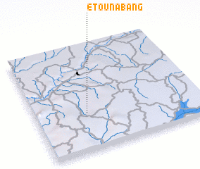 Places with similar names to Etounabang, Cameroon :: Disclaimer :: Information on this page comes without warranty of any kind |
||
|
Where is Etounabang? Elevation and coordinates ::
Latitude (lat): 4°22'0"N Longitude (lon): 12°19'0"E
Elevation (approx.): 656m (map arrows pan, magnifying glasses zoom) |
||
|
Visiting Etounabang? Hotel/Accommodation ::
Book a hotel in Etounabang Travel Guide ::
Buy a travel guide for Cameroon rental cars ::
car rental offers GPS waypoint ::
download a GPX waypoint (PoI) of Etounabang for your GPS receiver
|
||