|
search place name
|
||
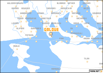
Galoué (Cameroon)Galoué is a town in Cameroon. An overview map of the region around Galoué is displayed below.
regional and 3d topo map of Galoué, Cameroon ::
Galoué airports ::
The nearest airport is NDJ - N'djamena Ndjamena Hassan Djamous, located 84.5 km east of Galoué.
Other airports nearby include MIU - Maiduguri (145.0 km south west), MVR - Maroua Salak (213.8 km south), Nearby towns ::
Blangafé (0.0km north) //
Héréimé (1.9km north) //
Orogadji (2.6km south east) //
Jokhanna (2.6km south east) //
Bédi (2.6km north west) //
Fima (4.1km south east) //
Djouka (4.1km north west) //
Damalgou (4.1km north east) //
Naga (5.4km west) //
Djabrari (5.4km west) //
Wumbo (5.7km east) //
Koubougé (5.7km west) //
Belgédé (5.7km east) //
Kabétoua (5.8km north) //
Ouangara (5.7km west) //
Nganawé (6.6km north west) //
Bénisawé (7.2km east) //
Amasadek (7.6km north) //
Oh (7.5km east) //
Malmadja (7.5km west) //
Fotokol (7.6km west) //
Gio (7.8km north east) //
Gégéri (8.2km north west) //
Rouroundé (9.1km north west) //
Ourochagama (10.4km north east) //
[all distances 'as the bird flies' and approximate] 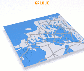 Places with similar names to Galoué, Cameroon ::
Disclaimer :: Information on this page comes without warranty of any kind |
||
|
Where is Galoué? Elevation and coordinates ::
Latitude (lat): 12°23'0"N Longitude (lon): 14°18'0"E
Elevation (approx.): 289m (map arrows pan, magnifying glasses zoom) |
||
|
Visiting Galoué? Hotel/Accommodation ::
Book a hotel in Galoué Travel Guide ::
Buy a travel guide for Cameroon rental cars ::
car rental offers GPS waypoint ::
download a GPX waypoint (PoI) of Galoué for your GPS receiver
|
||