|
search place name
|
||
Mamourdi (Cameroon)Mamourdi is a town in Cameroon. An overview map of the region around Mamourdi is displayed below.
regional and 3d topo map of Mamourdi, Cameroon ::

Mamourdi airports ::
The nearest airport is MVR - Maroua Salak, located 68.1 km south of Mamourdi.
Other airports nearby include NDJ - N'djamena Ndjamena Hassan Djamous (144.7 km north east), MIU - Maiduguri (156.0 km north west), GOU - Garoua (215.2 km south west), YOL - Yola (283.8 km south west), Nearby towns ::
Djoudé (4.1km south east) //
Ngalbiwa (5.2km north east) //
Ardo Ama (5.8km south) //
Mainari (6.6km north east) //
Moukjé (7.6km south) //
Mohoula (7.5km west) //
Djanpala (8.2km south east) //
Kossa (8.9km north east) //
Sava (9.2km south west) //
[all distances 'as the bird flies' and approximate] 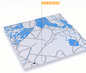 Places with similar names to Mamourdi, Cameroon ::
// Momart (DE)
// Mäemurati (EE)
// Mumurdia (BD)
// Mumbaradó (CO)
// Memberiete (CD)
// Maymorita (MX)
// Mamar Do (IR)
// Mambouroudou (GN)
// Mamourodou (GN)
// Mombert (FR)
Disclaimer :: Information on this page comes without warranty of any kind |
||
|
Where is Mamourdi? Elevation and coordinates ::
Latitude (lat): 11°4'0"N Longitude (lon): 14°16'0"E
Elevation (approx.): 352m (map arrows pan, magnifying glasses zoom) |
||
|
Visiting Mamourdi? Hotel/Accommodation ::
Book a hotel in Mamourdi Travel Guide ::
Buy a travel guide for Cameroon rental cars ::
car rental offers GPS waypoint ::
download a GPX waypoint (PoI) of Mamourdi for your GPS receiver
|
||