|
search place name
|
||
Mvolyé (Cameroon)Mvolyé is a town in Cameroon. An overview map of the region around Mvolyé is displayed below.
regional and 3d topo map of Mvolyé, Cameroon ::

Mvolyé airports ::
The nearest airport is YAO - Yaounde Ville, located 2.6 km east of Mvolyé.
Other airports nearby include BMM - Bitam (194.4 km south), DLA - Douala (198.7 km west), FOM - Foumban Nkounja (216.1 km north), BFX - Bafoussam (227.2 km north west), Nearby towns ::
Mvan (2.6km south east) //
Simbok (2.6km south west) //
Etoug (3.7km west) //
Ebé (4.1km south west) //
Ekoumdoum (4.1km south east) //
Ahala (4.1km south west) //
Mesamindongo (4.1km south east) //
Yaoundé (4.1km north east) //
Melen (4.1km north west) //
Odza II (5.2km south east) //
Mbalngong (5.2km south west) //
Mokolo (5.6km north) //
Méyo (5.6km south) //
Ekié (5.5km east) //
Awaé I (5.5km east) //
Nkomo (5.5km east) //
Mesa (5.9km north) //
Biting (5.8km east) //
Djoungolo (6.7km north east) //
Odza I (6.7km south east) //
Mimboman (6.7km north east) //
Afanoya (7.6km south) //
Minkan (7.6km south) //
Etoa (7.6km south) //
Mbala (7.6km north) //
Nkolbison (7.9km north west) //
Méhandan (8.3km south east) //
Nkolbikogo (8.3km south east) //
Leboudi II (9.3km north west) //
[all distances 'as the bird flies' and approximate] 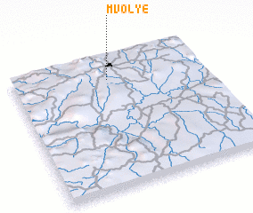 Places with similar names to Mvolyé, Cameroon ::
// Ma‘vā'-e ‘Olyā (IR)
Disclaimer :: Information on this page comes without warranty of any kind |
||
|
Where is Mvolyé? Elevation and coordinates ::
Latitude (lat): 3°50'0"N Longitude (lon): 11°30'0"E
Elevation (approx.): 691m (map arrows pan, magnifying glasses zoom) |
||
|
Visiting Mvolyé? Hotel/Accommodation ::
Book a hotel in Mvolyé Travel Guide ::
Buy a travel guide for Cameroon rental cars ::
car rental offers GPS waypoint ::
download a GPX waypoint (PoI) of Mvolyé for your GPS receiver
|
||