|
search place name
|
||
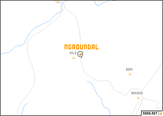
Ngaoundal (Adamaoua, Cameroon)Ngaoundal is a town in the Adamaoua region of Cameroon. An overview map of the region around Ngaoundal is displayed below.
regional and 3d topo map of Ngaoundal, Cameroon ::
Ngaoundal airports ::
The nearest airport is NGE - N'gaoundere Ngaoundere, located 100.1 km north of Ngaoundal.
Nearby towns ::
Milo (1.8km west) //
[all distances 'as the bird flies' and approximate] 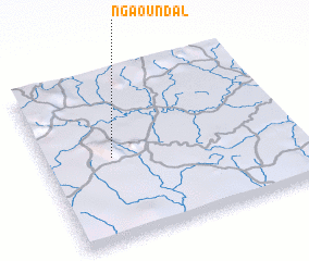 Places with similar names to Ngaoundal, Cameroon ::
// Nkandla (ZA)
// Nkantolo (ZA)
// Nkondla (ZA)
// Nkondlo (ZA)
// Niakundulu (CD)
// Ngandoulou (CG)
// Nakandala (LK)
// Ngandalo (ZM)
// Ngundel (ID)
// Nogon Toli (CN)
Disclaimer :: Information on this page comes without warranty of any kind |
||
|
Where is Ngaoundal? Elevation and coordinates ::
Latitude (lat): 6°30'0"N Longitude (lon): 13°16'0"E
Elevation (approx.): 921m (map arrows pan, magnifying glasses zoom) |
||
|
Visiting Ngaoundal? Hotel/Accommodation ::
Book a hotel in Ngaoundal Travel Guide ::
Buy a travel guide for Cameroon rental cars ::
car rental offers GPS waypoint ::
download a GPX waypoint (PoI) of Ngaoundal for your GPS receiver
|
||